As a task in my Ib Geo class, I sent a tweet out to ask people to tweet back where they read the tweet. (idea from Matt Podbury aka geographypods)
The map of the results was really interesting. As it was tagged with #ibgeography it attracted replied from my international Geography Colleagues, many of whom were on holiday.
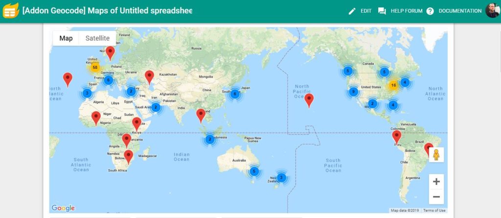
The results are in and we will now figure out how far the tweet travelled in one day
The map of my tweet (even though I only have a couple of hundred followers) is a nice example of globalisation and the effect of social media and the internet on global connections. A global PLN is enabled by the use of Twitter, 7097 views of the tweet via shares and retweets.
Furthest Distance travelled 17302 Km !
The Google MyMaps upload from the Google Sheet of responses is below.
Names were used from the Tweet or from your twitter profile, no private info used.
And the map created from the sheet using Geocode by awesome table can be seen below